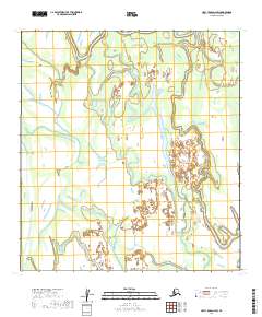
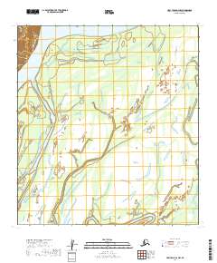
2019 Map of Holy Cross D-2 SW
USGS Topo · Published 2019About this map
Hydrography and public land divisions define this interior Alaskan landscape within the Yukon-Koyukuk region. This survey tracks the intricate drainage patterns of a wetland-heavy territory, organized by the rectangular grid of the Public Land Survey System. The map highlights the intersecting boundaries of T32n R57w, T32n R56w, T31n R57w, and T31n R56w. Unlike more settled regions, this area is characterized by its lack of established road infrastructure or named settlements, focusing instead on the precise natural elevation and watercourse data essential for wilderness navigation and land management. The 10-foot contour intervals provide high-resolution detail of the subtle topographic shifts across this river-fed terrain.
Find a feature on this map
4 named features on this map. Tap any name to fly to it.
Don’t see what you’re looking for? This feature index may not catch every label — zoom into the map to look around manually.
Map Details
Editions of this 2019 Holy Cross D-2 SW Map
This is the sole edition of this map. No revisions or reprints were ever made.
Other maps of this area

1951 · Holy Cross
USGS Topo · 1:250,000

1952 · Holy Cross C-2
USGS Topo · 1:63,360

1952 · Holy Cross D-2
USGS Topo · 1:63,360

1952 · Holy Cross D-3
USGS Topo · 1:63,360

1952 · Holy Cross C-3
USGS Topo · 1:63,360

1952 · Holy Cross
USGS Topo · 1:250,000
2017 · Holy Cross D-3 NE
USGS Topo · 1:25,000
2017 · Holy Cross D-3 SE
USGS Topo · 1:25,000
2017 · Holy Cross C-3 NE
USGS Topo · 1:25,000
2019 · Holy Cross D-2 NW
USGS Topo · 1:25,000