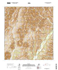
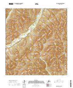
2017 Map of Holy Cross D-6 SW
USGS Topo · Published 2017About this map
East Fork Andreafsky River winds through the southeastern portion of this remote Alaskan interior landscape, representing the primary hydrological feature in an area defined by significant elevation changes. This 2017 survey reveals a terrain largely unpopulated by permanent structures or established roads, instead characterized by the intricate drainage patterns and marshy lowlands typical of the Kusilvak Census Area. The map highlights the vast township and range divisions of t32n r68w, t32n r67w, t31n r68w, and t31n r67w, providing a precise look at the land survey system in this portion of the Alaskan wilderness before more recent environmental changes or human encroachment.
Find a feature on this map
5 named features on this map. Tap any name to fly to it.
Don’t see what you’re looking for? This feature index may not catch every label — zoom into the map to look around manually.
Map Details
Editions of this 2017 Holy Cross D-6 SW Map
This is the sole edition of this map. No revisions or reprints were ever made.
Other maps of this area

1951 · Holy Cross
USGS Topo · 1:250,000

1952 · Kwiguk
USGS Topo · 1:250,000

1952 · Kwiguk D-1
USGS Topo · 1:63,360

1952 · Holy Cross C-6
USGS Topo · 1:63,360

1952 · Kwiguk C-1
USGS Topo · 1:63,360
1952 · Holy Cross D-6
USGS Topo · 1:63,360

1952 · Holy Cross
USGS Topo · 1:250,000
2017 · Holy Cross D-6 NW
USGS Topo · 1:25,000
2017 · Holy Cross D-6 NE
USGS Topo · 1:25,000
2017 · Holy Cross C-6 NW
USGS Topo · 1:25,000