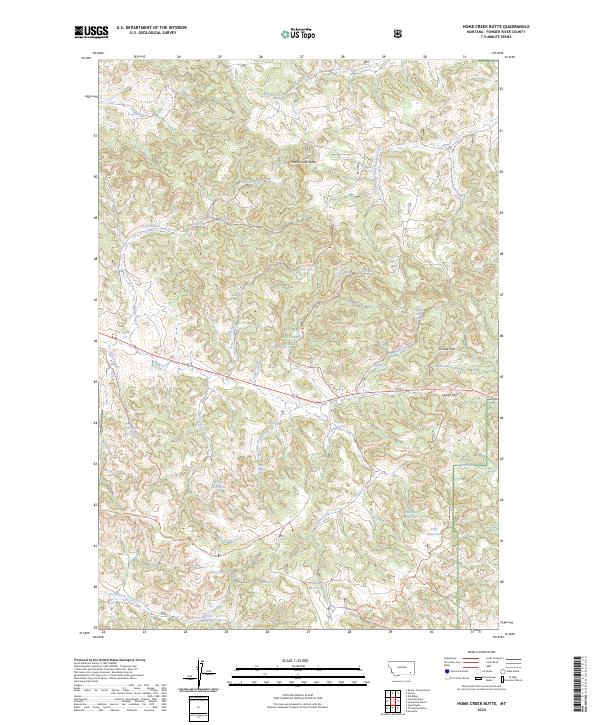
2024 Map of Home Creek Butte
USGS Topo · Published 2024About this map
Custer National Forest encompasses a landscape of significant elevation changes and seasonal water sources in southeastern Montana. The area is defined by a series of dramatic geographic markers, including Suicide Pass, Camps Pass, and the prominent Home Creek Butte. Ranching history and land management are visible through the inclusion of the Samuelson Ranch and numerous engineered water features such as Knudson Reservoir, Phillips Reservoir, and Tobin Reservoir.
Find a feature on this map
52 named features on this map. Tap any name to fly to it.
Don’t see what you’re looking for? This feature index may not catch every label — zoom into the map to look around manually.
Map Details
Editions of this 2024 Home Creek Butte Map
This is the sole edition of this map. No revisions or reprints were ever made.
Other maps of this area

1954 · Hardin
USGS Topo · 1:250,000

1954 · Ekalaka
USGS Topo · 1:250,000

1956 · Ekalaka
USGS Topo · 1:250,000

1957 · Hardin
USGS Topo · 1:250,000

1958 · Ekalaka
USGS Topo · 1:250,000

1958 · Hardin
USGS Topo · 1:250,000

1965 · Ekalaka
USGS Topo · 1:250,000

1966 · Sonnette
USGS Topo · 1:24,000

1966 · Coleman Draw
USGS Topo · 1:24,000

1966 · Stacey
USGS Topo · 1:24,000