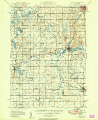
1949 Map of Homer
USGS Topo · Published 1949About this map
Agricultural life and rural education define the landscape of south-central Michigan in the late 1940s. The region is densely populated with small country schoolhouses like Putnam Sch and Sackett Sch, serving a patchwork of family-named settlements such as Wrights Corners and Dayburg. The New York Central railroad provides a vital industrial spine, connecting the more established hubs of Homer and Albion.
Find a feature on this map
104 named features on this map. Tap any name to fly to it.
Don’t see what you’re looking for? This feature index may not catch every label — zoom into the map to look around manually.
Map Details
Editions of this 1949 Homer Map
2 editions found

Other maps of this area

1918 · Battle Creek
USGS Topo · 1:62,500

1918 · Union City
USGS Topo · 1:62,500

1919 · Springport
USGS Topo · 1:62,500

1921 · Springport
USGS Topo · 1:62,500

1921 · Marshall
USGS Topo · 1:62,500

1923 · Marshall
USGS Topo · 1:62,500

1943 · Battle Creek
USGS Topo · 1:62,500

1943 · Marshall
USGS Topo · 1:62,500

1947 · Ceresco
USGS Topo · 1:24,000

1947 · Union City
USGS Topo · 1:62,500