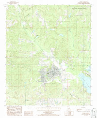
1986 Map of Homer
USGS Topo · Published 1986About this map
Homer serves as the focal point of this Claiborne Parish survey, situated at the intersection of a complex network of waterways that define the North Louisiana landscape. The town is surrounded by a dense hydrology of creeks and bayous, most notably Caney Creek to the south and the winding path of Bayou D'Arbonne to the east. The 1980s landscape reflects a mix of municipal development and natural conservation, with the Homer Municipal Airport and a Sewage Disposal Pond indicating local infrastructure, while the northern reaches of the map are preserved within the Kisatchie National Forest.
Find a feature on this map
28 named features on this map. Tap any name to fly to it.
Don’t see what you’re looking for? This feature index may not catch every label — zoom into the map to look around manually.
Map Details
Editions of this 1986 Homer Map
This is the sole edition of this map. No revisions or reprints were ever made.
Other maps of this area

1949 · Gibsland
USGS Topo · 1:62,500

1950 · Gibsland
USGS Topo · 1:62,500

1950 · Arcadia
USGS Topo · 1:62,500

1951 · Arcadia
USGS Topo · 1:62,500

1951 · Summerfield
USGS Topo · 1:62,500

1952 · Homer
USGS Topo · 1:62,500

1955 · Shreveport
USGS Topo · 1:250,000

1956 · Shreveport
USGS Topo · 1:250,000

1984 · Shreveport
USGS Topo · 1:250,000

1985 · Monroe North
USGS Topo · 1:100,000