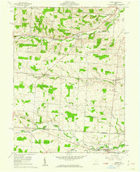
1961 Map of Homer
USGS Topo · Published 1962About this map
Homer and the surrounding townships of Liberty, Clinton, and Milford sit at the intersection of agriculture and transit in the early 1960s. The landscape is defined by the winding course of the North Fork Licking River and several small tributaries like Sycamore Creek and Vance Run. For family historians, the area is dotted with small burial grounds such as Dowell Cem, Bird Cem, and Hyatt Cem, often located near crossroads or along farm boundaries.
Find a feature on this map
35 named features on this map. Tap any name to fly to it.
Don’t see what you’re looking for? This feature index may not catch every label — zoom into the map to look around manually.
Map Details
Editions of this 1961 Homer Map
Other maps of this area

1908 · Granville
USGS Topo · 1:62,500

1909 · Newark
USGS Topo · 1:62,500

1910 · Granville
USGS Topo · 1:62,500

1912 · Gambier
USGS Topo · 1:62,500

1914 · Gambier
USGS Topo · 1:62,500

1915 · Fredericktown
USGS Topo · 1:62,500

1943 · Gambier
USGS Topo · 1:62,500

1943 · Fredericktown
USGS Topo · 1:62,500

1950 · Marion
USGS Topo · 1:250,000
1961 · Fredonia
USGS Topo · 1:24,000