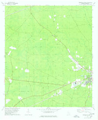
1978 Map of Homerville West
USGS Topo · Published 1978About this map
Homerville serves as the primary hub of this 1970s Clinch County landscape, where the Seaboard Coast Line railroad runs parallel to the highway through the heart of town. The area is defined by a series of distinct 'bays' or swampy depressions, including the curiously named Useless Bay, Light Bay, and Skinner Bay. These wetlands are intersected by a network of drainage features like the Canal and Cutting, suggesting a landscape managed for local industry or agriculture.
Find a feature on this map
26 named features on this map. Tap any name to fly to it.
Don’t see what you’re looking for? This feature index may not catch every label — zoom into the map to look around manually.
Map Details
Editions of this 1978 Homerville West Map
2 editions found
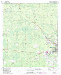
Other maps of this area

1953 · Waycross
USGS Topo · 1:250,000

1954 · Valdosta
USGS Topo · 1:250,000

1958 · Valdosta
USGS Topo · 1:250,000

1958 · Waycross
USGS Topo · 1:250,000

1959 · Valdosta
USGS Topo · 1:250,000

1968 · Homerville East
USGS Topo · 1:24,000

1968 · Midway
USGS Topo · 1:24,000

1968 · Cogdell
USGS Topo · 1:24,000

1971 · Du Pont
USGS Topo · 1:24,000

1971 · Stockton
USGS Topo · 1:24,000