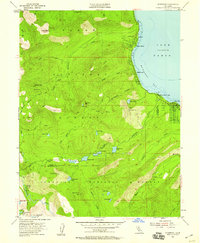
1955 Map of Homewood
USGS Topo · Published 1959About this map
The western shores of Lake Tahoe are defined by early lakeside settlements and the rugged high-elevation terrain of the Tahoe National Forest. In the mid-1950s, the shoreline of McKinney Bay was home to distinct communities such as Idlewild, Tahoe Pines, and Homewood, along with the Chambers Lodge complex. These areas represent the post-war era of California mountain recreation before modern development transformed the lake's perimeter.
Find a feature on this map
51 named features on this map. Tap any name to fly to it.
Don’t see what you’re looking for? This feature index may not catch every label — zoom into the map to look around manually.
Map Details
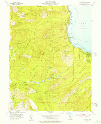
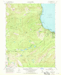
Editions of this 1955 Homewood Map
4 editions found

Other maps of this area

1889 · Pyramid Peak
USGS Topo · 1:125,000

1891 · Truckee
USGS Topo · 1:125,000

1891 · Pyramid Peak
USGS Topo · 1:125,000

1893 · Truckee
USGS Topo · 1:125,000

1895 · Pyramid Peak
USGS Topo · 1:125,000

1895 · Truckee
USGS Topo · 1:125,000

1896 · Pyramid Peak
USGS Topo · 1:125,000

1932 · Truckee
USGS Topo · 1:96,000

1940 · Truckee
USGS Topo · 1:125,000

1947 · Sacramento
USGS Topo · 1:250,000