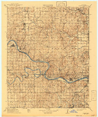
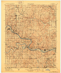
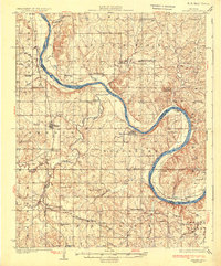
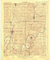
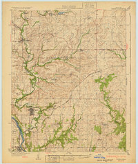
1915 Map of Hominy
USGS Topo · Published 1943About this map
The confluence of the Cimarron River and the Arkansas River defines the lower-central portion of this landscape, just as the early 20th-century oil and rail boom was reshaping the Osage and Creek nations. The Midland Valley RR and the St Louis And San Francisco RR intersect near the industrial hubs of Sapulpa and West Tulsa, while specialized settlements like Oil City (Barnsdall PO) reflect the region's energy-driven economy. Rural life remains clearly visible through the numerous country schools such as Mound Valley School and Lone Spring School, alongside traditional sites like Black Dog (Indian Village). This survey captures the complex transition from a series of scattered Indian Territory settlements to an integrated network of railroad towns and petroleum centers, before the mid-century creation of major reservoirs altered the courses of the local river valleys.
Find a feature on this map
80 named features on this map. Tap any name to fly to it.
Don’t see what you’re looking for? This feature index may not catch every label — zoom into the map to look around manually.
Map Details
Editions of this 1915 Hominy Map
2 editions found
Other maps of this area

1909 · Pawhuska
USGS Topo · 1:125,000

1910 · Pawhuska
USGS Topo · 1:125,000

1912 · Hominy
USGS Topo · 1:125,000

1915 · Hominy
USGS Topo · 1:125,000
1915 · Hominy
USGS Topo · 1:62,500
1929 · Yale
USGS Topo · 1:62,500
1929 · Skedee
USGS Topo · 1:62,500
1931 · Skedee
USGS Topo · 1:62,500
1932 · Yale
USGS Topo · 1:62,500
1932 · Fairfax
USGS Topo · 1:62,500