
1952 Map of Honey Grove
USGS Topo · Published 1953About this map
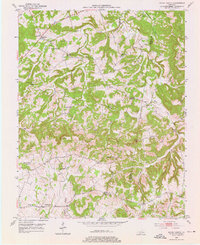
Honey Grove and Britmart serve as central nodes in this rural 1952 landscape along the border of Christian and Todd counties. The map documents a traditional agricultural society defined by its local institutions, including Shiloh Sch, Laytonsville Sch, and Perry Sch. The terrain is shaped by the winding courses of the Pond River and Buck Creek, with higher elevations marked by landmarks such as Pine Knob and the prominent Pilot Rock. This survey provides a record of land ownership and community heritage through numerous family-named sites, including the O'Daniel Cem and Henderson Cem. The presence of the Martin Gem near Fearsville hints at the area's local mining history. Cultural life is further anchored by community churches like Ebenezer Ch and Pleasant Hill Ch, which are scattered among the ridges and hollows such as Turnpike Hollow.
Find a feature on this map
32 named features on this map. Tap any name to fly to it.
Don’t see what you’re looking for? This feature index may not catch every label — zoom into the map to look around manually.
Map Details
Editions of this 1952 Honey Grove Map
3 editions found
Other maps of this area

1911 · Drakesboro
USGS Topo · 1:48,000

1912 · Nortonville
USGS Topo · 1:62,500

1913 · Drakesboro
USGS Topo · 1:62,500

1950 · Pembroke
USGS Topo · 1:24,000

1951 · Pembroke
USGS Topo · 1:24,000

1951 · Elkton
USGS Topo · 1:24,000

1951 · Hopkinsville
USGS Topo · 1:24,000

1952 · Kelly
USGS Topo · 1:24,000

1952 · Allegre
USGS Topo · 1:24,000

1952 · Crofton
USGS Topo · 1:24,000