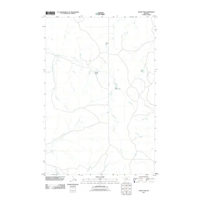
2011 Map of Hooky Dam
USGS Topo · Published 2011About this map
Sheep Creek and its many tributaries, including Lumpjaw Creek and Lone Tree Creek, define this rural section of Fallon County in the early 21st century. The landscape is marked by several localized water management structures, such as Solgren Dam and the namesake Hooky Dam on Back Creek. These small-scale impoundments reflect a cattle-ranching economy reliant on capturing seasonal runoff in an arid environment.
Find a feature on this map
11 named features on this map. Tap any name to fly to it.
Don’t see what you’re looking for? This feature index may not catch every label — zoom into the map to look around manually.
Map Details
Editions of this 2011 Hooky Dam Map
This is the sole edition of this map. No revisions or reprints were ever made.
Other maps of this area

1953 · Miles City
USGS Topo · 1:250,000

1957 · Miles City
USGS Topo · 1:250,000

1958 · Miles City
USGS Topo · 1:250,000

1969 · Knowlton
USGS Topo · 1:24,000

1969 · Tepee Butte NE
USGS Topo · 1:24,000

1969 · Tepee Butte
USGS Topo · 1:24,000
1980 · Miles City
USGS Topo · 1:100,000

1981 · Baker
USGS Topo · 1:100,000
1981 · Skunk Creek
USGS Topo · 1:24,000

1981 · Nelson Butte
USGS Topo · 1:24,000