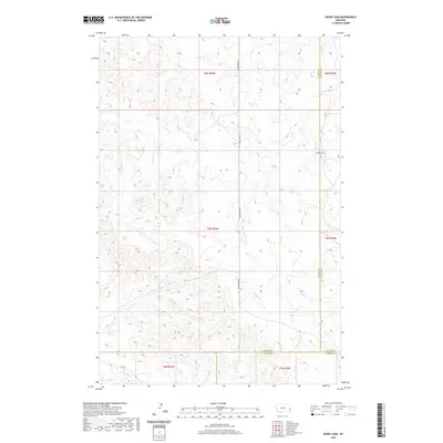
2020 Map of Hooky Dam
USGS Topo · Published 2020About this map
Sheep Cr and its various tributaries carve through the high plains of Eastern Montana in this modern topographic study. The landscape is defined by its drainages, including Lumpjaw Cr, Lone Tree Cr, and Trail Cr, which create a complex network of coulees and ridges. A significant man-made landmark, Hooky Dam, is situated along Back Cr near the border of Fallon and Custer Counties. The region remains primarily open range, with transportation limited to remote corridors like Foundation Rd and Rd 428. This map captures the intersection of three counties—Fallon, Custer, and Carter—providing a precise record of these rural boundaries and the natural watercourses that have historically dictated land use and ranching boundaries in this corner of the state.
Find a feature on this map
18 named features on this map. Tap any name to fly to it.
Don’t see what you’re looking for? This feature index may not catch every label — zoom into the map to look around manually.
Map Details
Editions of this 2020 Hooky Dam Map
This is the sole edition of this map. No revisions or reprints were ever made.
Other maps of this area

1953 · Miles City
USGS Topo · 1:250,000

1957 · Miles City
USGS Topo · 1:250,000

1958 · Miles City
USGS Topo · 1:250,000

1969 · Knowlton
USGS Topo · 1:24,000

1969 · Tepee Butte NE
USGS Topo · 1:24,000

1969 · Tepee Butte
USGS Topo · 1:24,000
1980 · Miles City
USGS Topo · 1:100,000

1981 · Baker
USGS Topo · 1:100,000
1981 · Skunk Creek
USGS Topo · 1:24,000

1981 · Nelson Butte
USGS Topo · 1:24,000