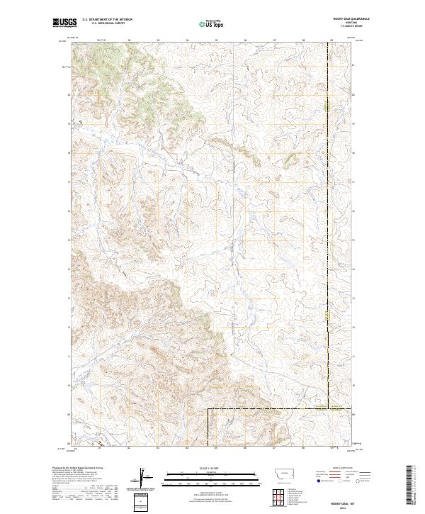
2024 Map of Hooky Dam
USGS Topo · Published 2024About this map
Sheep Creek and Lumpjaw Creek carve through this corner of Eastern Montana, defining a landscape of high plains drainage where Custer, Fallon, and Carter counties converge. The map illustrates a remote grazing territory at the intersection of several townships, including t6n r54e and t5n r55e. Local infrastructure is sparse, centered on the north-south transit of Foundation Rd and the presence of Rd 428 in the southern portion of the quadrangle. Other minor watercourses like Ash Creek, Back Creek, and Lone Tree Creek mark the breaks in the terrain, providing essential landmarks in a region defined more by its natural hydrology than by permanent settlements.
Find a feature on this map
15 named features on this map. Tap any name to fly to it.
Don’t see what you’re looking for? This feature index may not catch every label — zoom into the map to look around manually.
Map Details
Editions of this 2024 Hooky Dam Map
This is the sole edition of this map. No revisions or reprints were ever made.
Other maps of this area

1953 · Miles City
USGS Topo · 1:250,000

1957 · Miles City
USGS Topo · 1:250,000

1958 · Miles City
USGS Topo · 1:250,000

1969 · Knowlton
USGS Topo · 1:24,000

1969 · Tepee Butte NE
USGS Topo · 1:24,000

1969 · Tepee Butte
USGS Topo · 1:24,000
1980 · Miles City
USGS Topo · 1:100,000

1981 · Baker
USGS Topo · 1:100,000
1981 · Skunk Creek
USGS Topo · 1:24,000

1981 · Nelson Butte
USGS Topo · 1:24,000