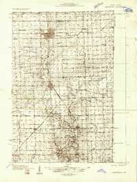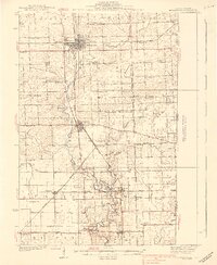
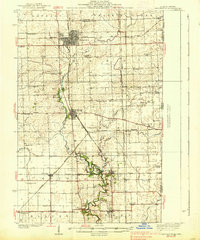
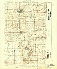
1938 Map of Hoopeston
USGS Topo · Published 1938About this map
Hoopeston serves as the industrial and social hub of this Vermilion County landscape, where the grain-belt economy is etched into a dense web of steel rails. The city sits at the intersection of the Chicago and Eastern Illinois and the New York Chicago and St Louis railroads, surrounded by a countryside dotted with local landmarks like Mann Chapel and Gundy Cem. The terrain is defined by the North Fork Vermilion River, which winds southward past Rossville and Alvin, feeding into a network of tributaries including Middle Branch and Stony Creek. This era of rural education is exceptionally well-documented, with dozens of neighborhood schools such as Bristle Ridge Sch, Redtop Sch, and Lee Sch serving small farm clusters. Other notable settlements include Cheneyville, Bismarck, and the rail junction at Rossville Junc.
Find a feature on this map
61 named features on this map. Tap any name to fly to it.
Don’t see what you’re looking for? This feature index may not catch every label — zoom into the map to look around manually.
Map Details
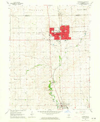
Editions of this 1938 Hoopeston Map
3 editions found
Historical Maps of Hoopeston Through Time
8 maps found