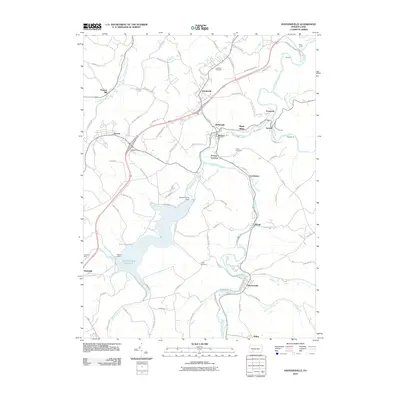
2010 Map of Hooversville
USGS Topo · Published 2010About this map
The Stonycreek River flows north through this part of Somerset County, anchoring a landscape defined by its historic industrial settlements and water resources. The massive Quemahoning Reservoir, held by the Quemahoning Dam, dominates the western portion of the map, while small communities such as Hooversville, Davidsville, and Hollsopple dot the valleys. This area reflects a legacy of milling and small-town industry, seen in labels like Thomas Mill, Morgans Mills, and Stanton Mills. Local family history is preserved at the Kaufman Cemetery and Custer Cemetery, providing specific points of interest for genealogists. The map also captures the layout of smaller hamlets such as Blough, Foustwell, and Seanor, many of which developed along the winding river and the Shade Creek drainage. Further south, the map identifies Camp Harmony and the village of Wilbur, illustrating the mix of residential, industrial, and recreational uses in this corner of Pennsylvania.
Find a feature on this map
90 named features on this map. Tap any name to fly to it.
Don’t see what you’re looking for? This feature index may not catch every label — zoom into the map to look around manually.
Map Details
Editions of this 2010 Hooversville Map
This is the sole edition of this map. No revisions or reprints were ever made.
Other maps of this area

1904 · Johnstown
USGS Topo · 1:62,500

1907 · Johnstown
USGS Topo · 1:62,500

1913 · Somerset
USGS Topo · 1:62,500

1914 · Windber
USGS Topo · 1:62,500

1915 · Somerset
USGS Topo · 1:62,500

1916 · Windber
USGS Topo · 1:62,500

1920 · New Florence
USGS Topo · 1:62,500

1921 · New Florence
USGS Topo · 1:48,000

1922 · New Florence
USGS Topo · 1:62,500

1944 · Somerset
USGS Topo · 1:62,500