2023 Map of Hooversville
USGS Topo · Published 2023About this map
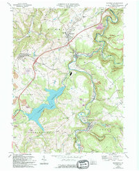
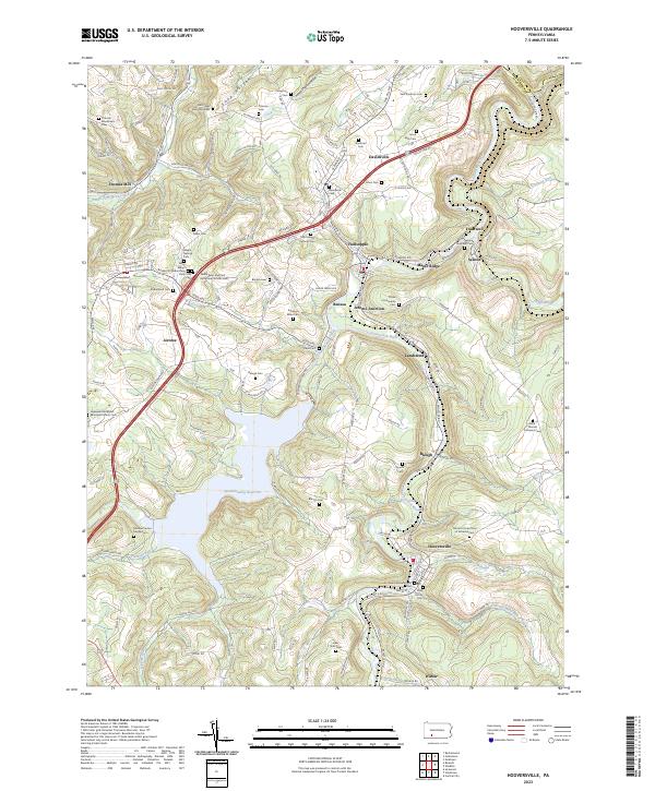
The Stonycreek River snakes through this Somerset County landscape, anchoring a series of small coal-and-rail settlements including Hooversville, Hollsopple, and Seanor. The area is remarkably dense with denominational heritage, preserved in specific sites like Saint Marys Russian Orthodox Cem and Saints Peter and Paul Byzantine Catholic Cem near Jerome. These burial grounds, alongside the Levi Yoder Burial Grounds and Thomas Mennonite Cem, reflect the complex ethnic and religious mosaic of the region’s industrial workforce and early farming families. Central to the geography is the massive Quemahoning Reservoir, which dominates the western half of the quadrangle. Smaller villages like Thomas Mill and Landstreet dot the terrain, connected by a network of hollows such as Soap Hollow and Moonshine Hollow that have historically shaped the movement of people and commerce between the river valleys and the upland ridges.
Find a feature on this map
129 named features on this map. Tap any name to fly to it.
Don’t see what you’re looking for? This feature index may not catch every label — zoom into the map to look around manually.
Map Details
Editions of this 2023 Hooversville Map
This is the sole edition of this map. No revisions or reprints were ever made.
Historical Maps of Paint Township Through Time
3 maps found