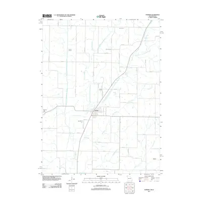
2011 Map of Hopkins
USGS Topo · Published 2011About this map
Hopkins sits at the convergence of several waterways in this northern Missouri landscape near the Iowa border. The town's grid is defined by its proximity to the West Fork One Hundred and Two River, the Middle Fork One Hundred and Two River, and the East Fork One Hundred and Two River, which snake through the agricultural terrain. This 2011 survey reveals a landscape deeply connected to its rural heritage, anchored by numerous family and community burial grounds such as Helm Cemetery, Williams Cemetery, and Willard Cemetery.
Find a feature on this map
56 named features on this map. Tap any name to fly to it.
Don’t see what you’re looking for? This feature index may not catch every label — zoom into the map to look around manually.
Map Details
Editions of this 2011 Hopkins Map
This is the sole edition of this map. No revisions or reprints were ever made.
Other maps of this area

1940 · Bedford
USGS Topo · 1:62,500

1940 · New Market
USGS Topo · 1:62,500

1940 · Parnell
USGS Topo · 1:62,500

1943 · Bedford
USGS Topo · 1:62,500

1943 · Parnell
USGS Topo · 1:62,500

1943 · Maryville
USGS Topo · 1:62,500

1943 · New Market
USGS Topo · 1:62,500

1955 · Nebraska City
USGS Topo · 1:250,000

1957 · Nebraska City
USGS Topo · 1:250,000

1958 · Nebraska City
USGS Topo · 1:250,000