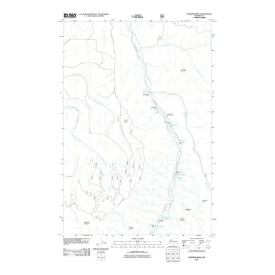
2011 Map of Hopkins Ridge
USGS Topo · Published 2011About this map
The Tucannon River carves a deep valley through the center of this landscape, acting as a primary drainage corridor for the high ridges of Garfield County. This 2011 survey illustrates a significant concentration of water management features along the river, including the Wooten State Fish Hatchery and a series of stepped impoundments such as Spring Lake, Blue Lake, and Rainbow Lake. These lakes, each managed with its own dam, represent a sophisticated hydrological network within the river's canyon.
Find a feature on this map
41 named features on this map. Tap any name to fly to it.
Don’t see what you’re looking for? This feature index may not catch every label — zoom into the map to look around manually.
Map Details
Editions of this 2011 Hopkins Ridge Map
This is the sole edition of this map. No revisions or reprints were ever made.
Other maps of this area

1937 · Pomeroy
USGS Topo · 1:96,000

1942 · Pomeroy
USGS Topo · 1:125,000

1955 · Pullman
USGS Topo · 1:250,000

1958 · Pullman
USGS Topo · 1:250,000

1967 · Rose Springs
USGS Topo · 1:24,000

1967 · Hopkins Ridge
USGS Topo · 1:24,000

1967 · Cahill Mtn
USGS Topo · 1:24,000
1967 · Pomeroy
USGS Topo · 1:24,000

1967 · Stentz Spring
USGS Topo · 1:24,000

1967 · Turner
USGS Topo · 1:24,000