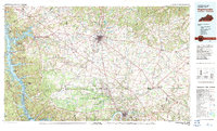
1980 Map of Hopkinsville
USGS Topo · Published 1983About this map
The Fort Campbell Military Reservation dominates the southern portion of this Kentucky and Tennessee borderlands survey, creating a massive federal footprint between Hopkinsville and Clarksville. To the west, the Cumberland River valley is transformed by Lake Barkley, a sprawling reservoir that defines the Land Between the Lakes and protects waterfowl habitat at the Cross Creeks National Wildlife Refuge.
Find a feature on this map
78 named features on this map. Tap any name to fly to it.
Don’t see what you’re looking for? This feature index may not catch every label — zoom into the map to look around manually.
Map Details
Editions of this 1980 Hopkinsville Map
This is the sole edition of this map. No revisions or reprints were ever made.
Other maps of this area

1903 · Nashville
USGS Topo · 1:125,000

1908 · Princeton
USGS Topo · 1:62,500

1909 · Dawson Springs
USGS Topo · 1:48,000

1910 · Princeton
USGS Topo · 1:62,500

1911 · Dawson Springs
USGS Topo · 1:62,500

1911 · Drakesboro
USGS Topo · 1:48,000

1911 · Dunmor
USGS Topo · 1:48,000

1912 · Nortonville
USGS Topo · 1:62,500

1913 · Drakesboro
USGS Topo · 1:62,500

1914 · Dunmor
USGS Topo · 1:62,500