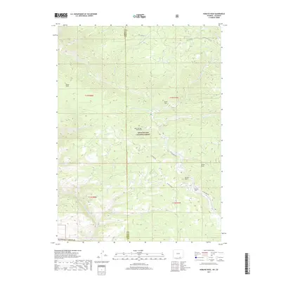
2017 Map of Horatio Rock
USGS Topo · Published 2017About this map
The Medicine Bow Mountains define this high-altitude landscape along the border of Carbon and Albany counties, where the Medicine Bow National Forest encompasses a network of drainages and prominent geological formations. The terrain is marked by distinctive outcroppings like Horatio Rock and Castle Rock, while the North Platte River moves through the southwestern corner of the quadrangle. A system of forest access roads, including Six Mile Gap Rd and Platte Ridge Rd, provides a framework for navigating the many creeks that feed this watershed, such as Douglas Cr and Pelton Cr. High-elevation meadows and basins like Pelton Park and Spruce Gulch punctuate the ridges, reflecting the traditional land use and natural character of this section of the Wyoming-Colorado borderlands.
Find a feature on this map
31 named features on this map. Tap any name to fly to it.
Don’t see what you’re looking for? This feature index may not catch every label — zoom into the map to look around manually.
Map Details
Editions of this 2017 Horatio Rock Map
This is the sole edition of this map. No revisions or reprints were ever made.
Other maps of this area

1906 · Medicine Bow
USGS Topo · 1:125,000

1908 · Medicine Bow
USGS Topo · 1:125,000

1950 · Northgate
USGS Topo · 1:24,000

1950 · Kings Canyon
USGS Topo · 1:24,000

1952 · Northgate
USGS Topo · 1:24,000

1952 · Kings Canyon
USGS Topo · 1:24,000

1954 · Rawlins
USGS Topo · 1:250,000

1954 · Craig
USGS Topo · 1:250,000

1955 · Independence Mountain
USGS Topo · 1:24,000

1955 · Kings Canyon
USGS Topo · 1:62,500