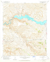
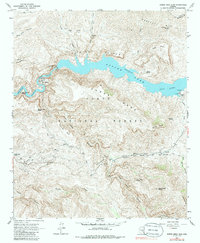
1964 Map of Horse Mesa Dam
USGS Topo · Published 1965About this map
Apache Lake, a massive reservoir on the Salt River, dominates this central Arizona landscape where the waters are held by the Horse Mesa Dam. The rugged geology of the Tonto National Forest is on display through prominent formations such as the Painted Cliffs and Black Cross Butte. Within the deep canyons and high mesas, human presence is marked by isolated outposts like Adams Camp and the small settlement at Horse Mesa.
Find a feature on this map
43 named features on this map. Tap any name to fly to it.
Don’t see what you’re looking for? This feature index may not catch every label — zoom into the map to look around manually.
Map Details
Editions of this 1964 Horse Mesa Dam Map
5 editions found
Other maps of this area

1900 · Florence
USGS Topo · 1:125,000

1902 · Florence
USGS Topo · 1:125,000

1907 · Roosevelt
USGS Topo · 1:125,000

1909 · Four Peaks
USGS Topo · 1:125,000

1912 · Roosevelt
USGS Topo · 1:125,000

1948 · Superior
USGS Topo · 1:62,500

1948 · Iron Mountain
USGS Topo · 1:24,000

1949 · Iron Mountain
USGS Topo · 1:24,000

1954 · Mesa
USGS Topo · 1:250,000

1956 · Goldfield
USGS Topo · 1:24,000