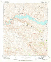
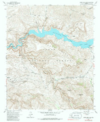
1964 Map of Horse Mesa Dam
USGS Topo · Published 1971About this map
Apache Lake winds through the dramatic topography of the Tonto National Forest in this mid-1960s survey. The landscape is defined by the massive Horse Mesa Dam, which regulates the Salt River and creates a steep-walled reservoir framed by the Painted Cliffs and Mazatzal Mts. The map reveals a transition between hydraulic engineering and wilderness, where infrastructure like the Highway Dept Maintenance Yard sits not far from remote features like Browns Cave and the Pack Trail.
Find a feature on this map
49 named features on this map. Tap any name to fly to it.
Don’t see what you’re looking for? This feature index may not catch every label — zoom into the map to look around manually.
Map Details
Editions of this 1964 Horse Mesa Dam Map
5 editions found
Other maps of this area

1900 · Florence
USGS Topo · 1:125,000

1902 · Florence
USGS Topo · 1:125,000

1907 · Roosevelt
USGS Topo · 1:125,000

1909 · Four Peaks
USGS Topo · 1:125,000

1912 · Roosevelt
USGS Topo · 1:125,000

1948 · Superior
USGS Topo · 1:62,500

1948 · Iron Mountain
USGS Topo · 1:24,000

1949 · Iron Mountain
USGS Topo · 1:24,000

1954 · Mesa
USGS Topo · 1:250,000

1956 · Goldfield
USGS Topo · 1:24,000