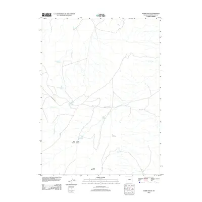
2012 Map of Horse Ranch
USGS Topo · Published 2012About this map
Horse Ranch and a network of high-desert water management features characterize this corner of Sweetwater County in the early 21st century. The landscape is defined by its arid drainage systems, where seasonal water is captured in numerous reservoirs like Staley Corral Reservoir, Calamagrottis Reservoir, and Green Sandstone Reservoir. These small-scale impoundments, alongside natural features such as Moonshine Spring and Box Spring, reflect the vital importance of water access for livestock and wild game in this remote part of Wyoming.
Find a feature on this map
18 named features on this map. Tap any name to fly to it.
Don’t see what you’re looking for? This feature index may not catch every label — zoom into the map to look around manually.
Map Details
Editions of this 2012 Horse Ranch Map
This is the sole edition of this map. No revisions or reprints were ever made.
Other maps of this area

1954 · Ogden
USGS Topo · 1:250,000

1954 · Rock Springs
USGS Topo · 1:250,000

1958 · Ogden
USGS Topo · 1:250,000

1958 · Rock Springs
USGS Topo · 1:250,000

1960 · Ogden
USGS Topo · 1:250,000

1962 · Rock Springs
USGS Topo · 1:250,000

1964 · Butcher Knife Draw
USGS Topo · 1:24,000
1964 · Mc Kinnon
USGS Topo · 1:24,000

1964 · Soap Holes Reservoir
USGS Topo · 1:24,000

1964 · Black Spring Reservoir
USGS Topo · 1:24,000