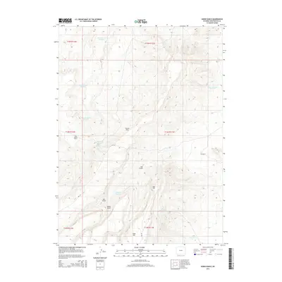
2015 Map of Horse Ranch
USGS Topo · Published 2015About this map
Mass Mtn and Cedar Mtn dominate this high-altitude landscape in Sweetwater County, where early 21st-century ranching and water management are clearly visible through a network of small, specialized catchments. The remote character of the area is emphasized by its reliance on these features, including the Staley Corral Reservoir and Ringdahl Reservoir, which support local livestock operations near Horse Ranch. The terrain is carved by deep geographic features like East Canyon and Cattail Draw, which separate high plateaus such as the Big Hollow Bench. Transportation through this high desert country follows the primitive Rim Rd, tracing the natural topography between spring-fed water sources like Moonshine Spring and Box Spring. This map captures a specific moment in the land-use history of Wyoming's ranching frontier, documenting the vital water infrastructure necessary for survival in this environment.
Find a feature on this map
25 named features on this map. Tap any name to fly to it.
Don’t see what you’re looking for? This feature index may not catch every label — zoom into the map to look around manually.
Map Details
Editions of this 2015 Horse Ranch Map
This is the sole edition of this map. No revisions or reprints were ever made.
Other maps of this area

1954 · Ogden
USGS Topo · 1:250,000

1954 · Rock Springs
USGS Topo · 1:250,000

1958 · Ogden
USGS Topo · 1:250,000

1958 · Rock Springs
USGS Topo · 1:250,000

1960 · Ogden
USGS Topo · 1:250,000

1962 · Rock Springs
USGS Topo · 1:250,000

1964 · Butcher Knife Draw
USGS Topo · 1:24,000
1964 · Mc Kinnon
USGS Topo · 1:24,000

1964 · Soap Holes Reservoir
USGS Topo · 1:24,000

1964 · Black Spring Reservoir
USGS Topo · 1:24,000