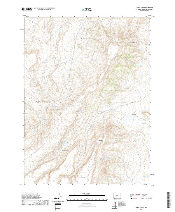
2021 Map of Horse Ranch
USGS Topo · Published 2021About this map
Horse Ranch serves as a lone focal point in this high-desert landscape of Sweetwater County, where the management of water is the primary signature on the land. A sophisticated network of artificial catchments, including Staley Corral Reservoir, Box Spring Reservoir, and Calamagrostis Reservoir, punctuates the arid terrain between major elevations. The geography is defined by prominent landforms like Cedar Mtn and Mass Mtn, which overlook a complex system of drainage features such as Cattail Draw and East Canyon.
Find a feature on this map
26 named features on this map. Tap any name to fly to it.
Don’t see what you’re looking for? This feature index may not catch every label — zoom into the map to look around manually.
Map Details
Editions of this 2021 Horse Ranch Map
This is the sole edition of this map. No revisions or reprints were ever made.
Other maps of this area

1954 · Ogden
USGS Topo · 1:250,000

1954 · Rock Springs
USGS Topo · 1:250,000

1958 · Ogden
USGS Topo · 1:250,000

1958 · Rock Springs
USGS Topo · 1:250,000

1960 · Ogden
USGS Topo · 1:250,000

1962 · Rock Springs
USGS Topo · 1:250,000

1964 · Butcher Knife Draw
USGS Topo · 1:24,000
1964 · Mc Kinnon
USGS Topo · 1:24,000

1964 · Soap Holes Reservoir
USGS Topo · 1:24,000

1964 · Black Spring Reservoir
USGS Topo · 1:24,000