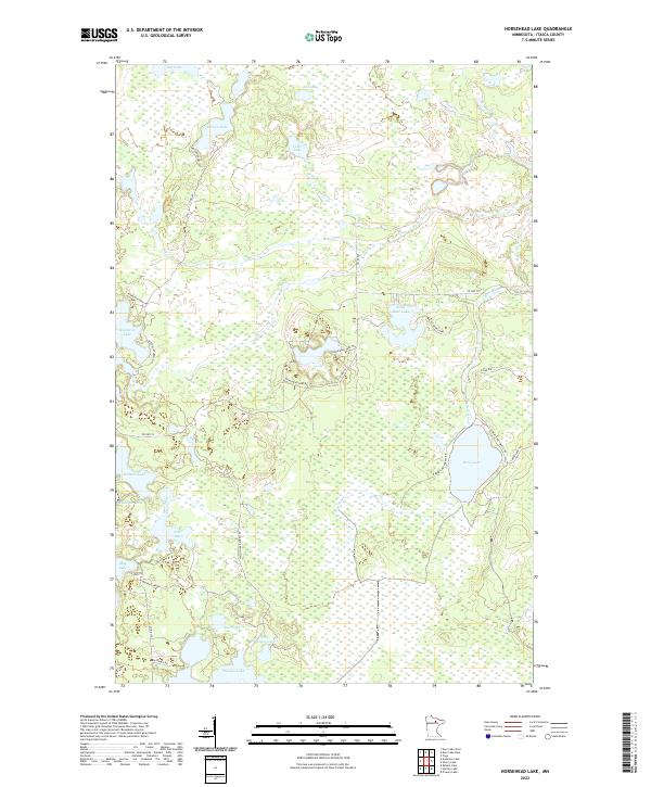
2022 Map of Horsehead Lake
USGS Topo · Published 2022About this map
Bear Lake and the winding Bear River dominate this pocket of the North Woods, where the landscape is defined by an intricate network of glacial lakes and wetlands. The area is intersected by several forest roads and trails, including the Wasson Lake Forest Rd and the Napolean Lake Trl, which provide access to more remote waters like Napoleon Lake and Wilson Lake. The map illustrates a largely uninhabited wilderness character, with the Lily Pond and Rainbow Lake tucked into the complex hydrology between the river and the larger lake basins. This survey serves as a clear guide to the region's topography, highlighting the subtle elevation changes that separate drainages such as Little Bear Lake from Little Wasson Lake.
Find a feature on this map
39 named features on this map. Tap any name to fly to it.
Don’t see what you’re looking for? This feature index may not catch every label — zoom into the map to look around manually.
Map Details
Editions of this 2022 Horsehead Lake Map
This is the sole edition of this map. No revisions or reprints were ever made.
Other maps of this area

1919 · Release
USGS Topo · 1:62,500

1943 · Release
USGS Topo · 1:62,500

1954 · Hibbing
USGS Topo · 1:250,000

1957 · Hibbing
USGS Topo · 1:250,000

1958 · Hibbing
USGS Topo · 1:250,000

1964 · Hibbing
USGS Topo · 1:250,000

1964 · Sherry Lake
USGS Topo · 1:24,000
1964 · O'Leary Lake
USGS Topo · 1:24,000

1970 · Deer Lake East
USGS Topo · 1:24,000
1970 · Anderson Lake
USGS Topo · 1:24,000