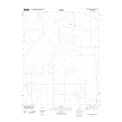
2012 Map of Horseshoe Hill
USGS Topo · Published 2012About this map
Wampus Cat Springs and the eponymous Horseshoe Hill define this high plains landscape in the Oklahoma Panhandle. This area, located in Texas County, is characterized by a sparse, utilitarian network of county roads including Co Road B and Co Road F, which crisscross the territory to serve isolated ranching and agricultural operations. Natural water sources like Cottonwood Cr and the unique namesake of Peckenpaugh Lake provide rare hydrological markers in an otherwise dry terrain. This 2012 survey illustrates the modern layout of rural infrastructure, featuring the transition between local routes and more established paths such as Ranch Road 1267 on the eastern edge. The map captures the enduring character of the Panhandle, where named springs and hills remain vital landmarks for navigation and land management.
Find a feature on this map
15 named features on this map. Tap any name to fly to it.
Don’t see what you’re looking for? This feature index may not catch every label — zoom into the map to look around manually.
Map Details
Editions of this 2012 Horseshoe Hill Map
This is the sole edition of this map. No revisions or reprints were ever made.
Other maps of this area

1954 · Perryton
USGS Topo · 1:250,000

1958 · Perryton
USGS Topo · 1:250,000

1962 · Hansford Camp
USGS Topo · 1:24,000

1962 · Waka SW
USGS Topo · 1:24,000

1968 · Hardesty
USGS Topo · 1:24,000

1968 · Hardesty SE
USGS Topo · 1:24,000

1973 · Farnsworth
USGS Topo · 1:24,000

1973 · Horseshoe Hill
USGS Topo · 1:24,000

1973 · Waka
USGS Topo · 1:24,000

1973 · Bryans Corner SW
USGS Topo · 1:24,000