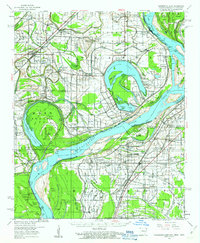
1960 Map of Horseshoe Lake
USGS Topo · Published 1963About this map
The Mississippi River and its shifting backwaters dominate this Delta landscape at the start of the 1960s, a period when large-scale agriculture and established river landings still defined the region. The map reveals an intricate network of river-tied communities and plantations, such as Columbia Plantation and Green River Plantation, alongside numerous small churches and schools that served the local workforce, including St Lukes Ch & Sch and Bruins Sch. The prominent oxbow of Horseshoe Lake serves as a focal point for recreation, highlighted by the Five Lakes Club and Horseshoe Lake Club. This survey provides essential detail for genealogists tracing family names through rural landmarks like Davis Biggs Farm or the many landing points along the banks, such as Pinckney Ldg and Bledsoe Ldg, which reflect the area's long-standing reliance on river transport and fertile alluvial soil.
Find a feature on this map
135 named features on this map. Tap any name to fly to it.
Don’t see what you’re looking for? This feature index may not catch every label — zoom into the map to look around manually.
Map Details
Editions of this 1960 Horseshoe Lake Map
2 editions found
Other maps of this area

1908 · Hollywood
USGS Topo · 1:24,000

1908 · Lake Cormorant
USGS Topo · 1:24,000

1912 · Lake Cormorant
USGS Topo · 1:31,680

1913 · Hollywood
USGS Topo · 1:31,680

1916 · Memphis
USGS Topo · 1:62,500

1925 · Memphis
USGS Topo · 1:48,000

1927 · Memphis
USGS Topo · 1:62,500

1931 · Horseshoe Lake
USGS Topo · 1:62,500

1932 · Horn Lake
USGS Topo · 1:48,000

1932 · Crenshaw
USGS Topo · 1:62,500