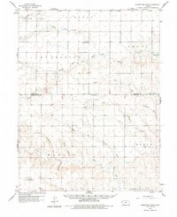
1959 Map of Horsethief Draw
USGS Topo · Published 1978About this map
The High Plains of western Kansas are defined here by a network of seasonal watercourses and draws that feed into the Smoky Hill River system. This mid-century landscape shows a rural environment where essential community nodes like the Sandy Hill Sch and Fairview Cem serve a sparsely populated ranching and farming district. The topography is surprisingly complex for the plains, featuring the Sandy Hill prominence and geological landmarks like Horsethief Cave, which overlook the winding paths of Turtle Creek and Meyers Draw.
Find a feature on this map
27 named features on this map. Tap any name to fly to it.
Don’t see what you’re looking for? This feature index may not catch every label — zoom into the map to look around manually.
Map Details
Editions of this 1959 Horsethief Draw Map
2 editions found

Other maps of this area

1892 · Cheyenne Wells
USGS Topo · 1:125,000

1894 · Cheyenne Wells
USGS Topo · 1:125,000

1954 · Limon
USGS Topo · 1:250,000

1954 · Lamar
USGS Topo · 1:250,000

1954 · Goodland
USGS Topo · 1:250,000

1955 · Scott City
USGS Topo · 1:250,000

1956 · Goodland
USGS Topo · 1:250,000

1957 · Limon
USGS Topo · 1:250,000

1957 · Goodland
USGS Topo · 1:250,000

1958 · Limon
USGS Topo · 1:250,000