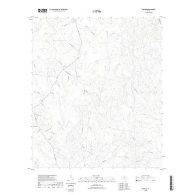
2019 Map of Hortense
USGS Topo · Published 2019About this map
Hickman Cr and Big Sandy Cr define the hydrologic character of this Polk County landscape, which is defined by a dense network of minor tributaries like Coontop Cr, Smith Cr, and Bear Cr. The rural road system serves as a geographic record of local families and early communities, with routes such as James Davis Rd, William Hood Rd, and Abernathy providing access to isolated homesteads and family plots.
Find a feature on this map
54 named features on this map. Tap any name to fly to it.
Don’t see what you’re looking for? This feature index may not catch every label — zoom into the map to look around manually.
Map Details
Editions of this 2019 Hortense Map
This is the sole edition of this map. No revisions or reprints were ever made.
Other maps of this area

1954 · Beaumont
USGS Topo · 1:250,000

1955 · Camden
USGS Topo · 1:62,500

1955 · New Willard
USGS Topo · 1:62,500

1957 · Beaumont
USGS Topo · 1:250,000

1958 · Livingston
USGS Topo · 1:62,500

1958 · Segno
USGS Topo · 1:62,500

1984 · Hortense
USGS Topo · 1:24,000
1984 · Chester
USGS Topo · 1:24,000

1984 · Soda
USGS Topo · 1:24,000

1984 · Beaumont
USGS Topo · 1:250,000