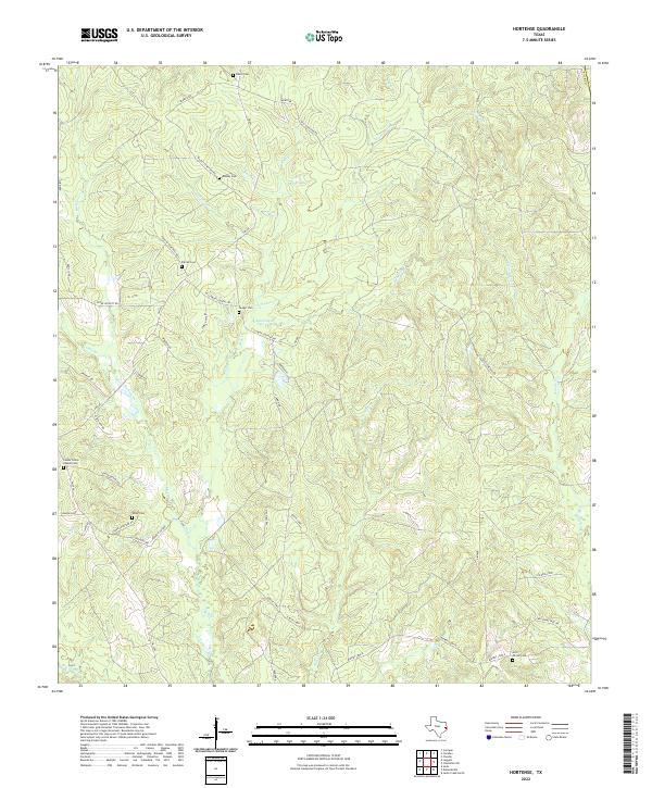
2022 Map of Hortense
USGS Topo · Published 2022About this map
Small family burial grounds and winding watercourses define this pocket of the East Texas Piney Woods in Polk County. The landscape is largely rural and wooded, marked by a high density of small cemeteries such as Beard Cem, Feagin Cem, and Center Grove Chapel Cem. These sites, often situated near family-named landmarks like Beard Xing, serve as significant markers for genealogists tracing early residents of the area. The settlement of Mentone sits near the headwaters of Bear Creek and Smith Creek, part of a complex drainage network that includes Big Sandy Creek and Mill Creek. The road system, including FM 942 and numerous named loops like Baskin Loop and Wilson Loop, follows the natural contours of the terrain rather than a strict grid, reflecting the historical development of timber and agricultural interests in this region.
Find a feature on this map
58 named features on this map. Tap any name to fly to it.
Don’t see what you’re looking for? This feature index may not catch every label — zoom into the map to look around manually.
Map Details
Editions of this 2022 Hortense Map
This is the sole edition of this map. No revisions or reprints were ever made.
Other maps of this area

1954 · Beaumont
USGS Topo · 1:250,000

1955 · Camden
USGS Topo · 1:62,500

1955 · New Willard
USGS Topo · 1:62,500

1957 · Beaumont
USGS Topo · 1:250,000

1958 · Livingston
USGS Topo · 1:62,500

1958 · Segno
USGS Topo · 1:62,500

1984 · Hortense
USGS Topo · 1:24,000
1984 · Chester
USGS Topo · 1:24,000

1984 · Soda
USGS Topo · 1:24,000

1984 · Beaumont
USGS Topo · 1:250,000