Loading...
Loading map...1894 Map of Hot Springs
USGS Topo · Published 1902About this map
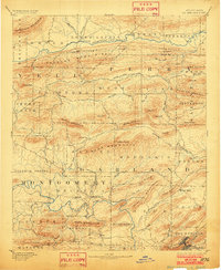
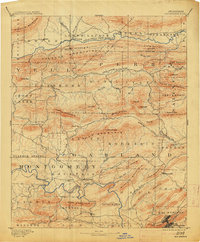
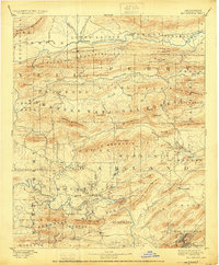
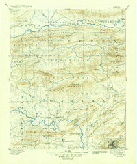
Hot Springs stands as the primary hub of this 1894 landscape, situated at the edge of West Mountain near the canyon known as The Gorge. The topography is dominated by the parallel ridges of the Fourche Mountains and the Crystal Mountain range, which dictate the drainage of the Ouachita River and the Fourche La Fave River. Small agricultural and timber settlements are scattered throughout the river valleys, including Buckville, Cedar Glades, and Rover.
Find a feature on this map
84 named features on this map. Tap any name to fly to it.
Don’t see what you’re looking for? This feature index may not catch every label — zoom into the map to look around manually.
Map Details
Date Portrayed1894
Date Published1902
PublisherU.S. Geological Survey
Map TypeTopographic
Scale1:125,000
Physical Dimensions16.5 x 20.1 inches
Editions of this 1894 Hot Springs Map
5 editions found

Historical Maps of Hot Springs Through Time

Featured Locations
Source Details
SourceU.S. Geological Survey
CopyrightPublic Domain