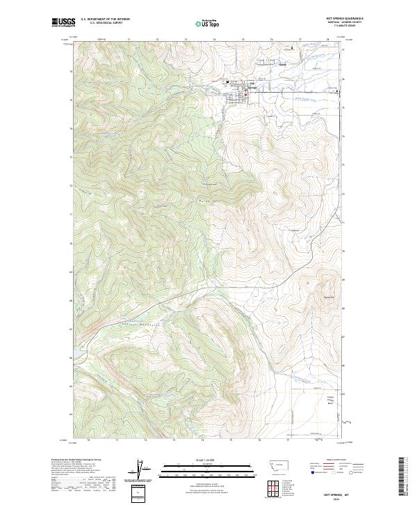
2024 Map of Hot Springs
USGS Topo · Published 2024About this map
Hot Springs and the nearby community of Camas occupy the high valley between the Cabinet Mountains and the rolling terrain of the Camas Prairie Basin. This 2024 survey depicts a landscape defined by water management and family history, where the Camas Canal and Hot Springs Creek navigate the base of local landmarks like Burke Hill and Markle Hill. The distribution of local cemeteries, including Ventling Cem, Maillet Cem, and Moore Cem, provides a geographic record of early 20th-century settlement patterns in this part of Sanders County.
Find a feature on this map
57 named features on this map. Tap any name to fly to it.
Don’t see what you’re looking for? This feature index may not catch every label — zoom into the map to look around manually.
Map Details
Editions of this 2024 Hot Springs Map
This is the sole edition of this map. No revisions or reprints were ever made.
Other maps of this area

1956 · Wallace
USGS Topo · 1:250,000

1959 · Perma
USGS Topo · 1:62,500

1959 · Plains
USGS Topo · 1:62,500

1960 · Wallace
USGS Topo · 1:250,000

1964 · Markle Pass
USGS Topo · 1:24,000

1964 · Coney Peak
USGS Topo · 1:24,000

1964 · Baldy Lake
USGS Topo · 1:24,000

1964 · Lonepine
USGS Topo · 1:24,000

1964 · Hot Springs
USGS Topo · 1:24,000
1964 · Hot Springs NE
USGS Topo · 1:24,000