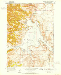
1950 Map of Hot Springs SE
USGS Topo · Published 1979About this map
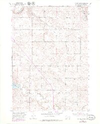
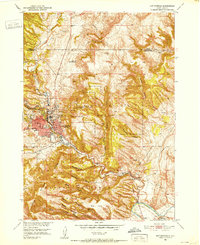
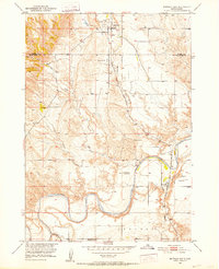
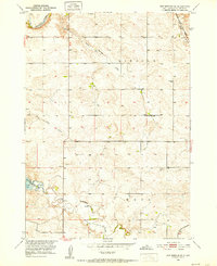
Cheyenne River waters flow through this South Dakota landscape, shaping a terrain defined by significant drainage systems and early mid-century infrastructure. The southern portion of the map is dominated by the Angostura Reservoir, a Bureau of Reclamation project that transformed the local hydrology. This 1950 survey, updated with late-1970s revisions, provides a clear view of rural settlement patterns along the Chicago and North Western rail line and scattered rural landmarks. Evidence of early community life is visible in the distribution of school and burial sites across the plains. Several family and community cemeteries are documented, including Fairview Cem to the north and Horsehead Cem and Smithwick Cem further south. Education in this ranching country centered on sites like Green Valley Sch, while the natural topography is marked by named seasonal watercourses such as Slate Spring Draw and Horse Camp Draw.
Find a feature on this map
14 named features on this map. Tap any name to fly to it.
Don’t see what you’re looking for? This feature index may not catch every label — zoom into the map to look around manually.
Map Details
Editions of this 1950 Hot Springs SE Map
2 editions found
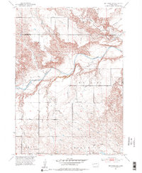
Other maps of this area

1896 · Oelrichs
USGS Topo · 1:125,000

1900 · Oelrichs
USGS Topo · 1:125,000
1950 · Hot Springs
USGS Topo · 1:24,000
1950 · Buffalo Gap
USGS Topo · 1:24,000
1950 · Hot Springs SE
USGS Topo · 1:24,000
1950 · Angostura Reservoir
USGS Topo · 1:24,000
1951 · Smithwick NW
USGS Topo · 1:24,000

1955 · Hot Springs
USGS Topo · 1:250,000
1982 · Smithwick
USGS Topo · 1:25,000
1982 · Lone Well Creek East
USGS Topo · 1:24,000