
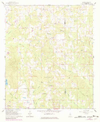
1962 Map of House
USGS Topo · Published 1963About this map
The borderlands of Neshoba and Kemper counties are defined here by a network of rural congregations and family burial grounds during the early 1960s. Small community hubs like DeWeese and House anchor a landscape drained by Okatibbee Creek and its many tributaries, including Cushtusia Creek and Tullashua Creek. The distribution of churches, such as Mars Hill Ch and New Hope Ch, alongside institutions like the East Neshoba Sch, suggests a social structure rooted in localized settlements connected by light-duty roads.
Find a feature on this map
37 named features on this map. Tap any name to fly to it.
Don’t see what you’re looking for? This feature index may not catch every label — zoom into the map to look around manually.
Map Details
Editions of this 1962 House Map
3 editions found
Other maps of this area

1953 · Meridian
USGS Topo · 1:250,000

1957 · Meridian
USGS Topo · 1:250,000

1962 · Lynville
USGS Topo · 1:24,000

1962 · Owl Creek
USGS Topo · 1:24,000

1962 · Center Hill
USGS Topo · 1:24,000

1962 · Post
USGS Topo · 1:24,000

1962 · Moscow
USGS Topo · 1:24,000

1965 · Meridian
USGS Topo · 1:250,000

1972 · Deemer
USGS Topo · 1:24,000

1972 · Union East
USGS Topo · 1:24,000