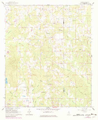
1962 Map of House
USGS Topo · Published 1982About this map
De Weese and the settlement of House anchor this rural landscape along the boundary of Neshoba and Kemper Counties. The area is defined by a dense network of local landmarks that suggest a long-established community structure, particularly through its numerous rural congregations such as Mars Hill Ch, McClain Chapel, and Hopewell Ch. Educational and civic life is centered around the East Neshoba Sch, while family history is recorded at several burial sites, including the Spanish Oak Ch Cem, Wilson Cem, and McDonald Cem.
Find a feature on this map
37 named features on this map. Tap any name to fly to it.
Don’t see what you’re looking for? This feature index may not catch every label — zoom into the map to look around manually.
Map Details
Editions of this 1962 House Map
3 editions found
Other maps of this area

1953 · Meridian
USGS Topo · 1:250,000

1957 · Meridian
USGS Topo · 1:250,000

1962 · House
USGS Topo · 1:24,000

1962 · Lynville
USGS Topo · 1:24,000

1962 · Owl Creek
USGS Topo · 1:24,000

1962 · Center Hill
USGS Topo · 1:24,000

1962 · Post
USGS Topo · 1:24,000

1962 · Moscow
USGS Topo · 1:24,000

1965 · Meridian
USGS Topo · 1:250,000

1972 · Deemer
USGS Topo · 1:24,000