
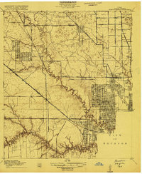
1915 Map of Houston Heights
USGS Topo · Published 1915About this map
Independence Heights and Sunset Heights stand as early examples of residential expansion north of the City of Houston during the mid-1910s. This survey, conducted under the direction of George Otis Smith and County Judge W. H. Ward, captures the transition of the Harris County landscape from open prairie and bayou bottomlands into a structured grid of suburban development. The importance of rail transport is evident at Eureka Junction, where the Missouri Kansas and Texas Road and the Houston and Texas Central Road converge near the growing neighborhood of Cottage Grove. Rural life still persists on the periphery, marked by isolated institutions like Durkee School and Little York School. The intricate drainage of the region is defined by the winding course of White Oak Bayou and the smaller Brick House Gully, which shaped the early platting of these historic Houston additions.
Find a feature on this map
21 named features on this map. Tap any name to fly to it.
Don’t see what you’re looking for? This feature index may not catch every label — zoom into the map to look around manually.
Map Details
Editions of this 1915 Houston Heights Map
2 editions found
Other maps of this area

1915 · Bellaire
USGS Topo · 1:24,000

1915 · Park Place
USGS Topo · 1:24,000

1915 · Alief
USGS Topo · 1:24,000

1915 · Hillendahl
USGS Topo · 1:24,000

1916 · Aldine
USGS Topo · 1:24,000

1916 · Settegast
USGS Topo · 1:24,000

1916 · Satsuma
USGS Topo · 1:24,000

1916 · Humble
USGS Topo · 1:24,000

1918 · Hillendahl
USGS Topo · 1:31,680

1919 · Aldine
USGS Topo · 1:31,680