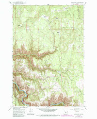
1964 Map of Howard Butte
USGS Topo · Published 1986About this map
Smith Mountain and the high ridges of the Wallowa National Forest define this landscape along the Union and Wallowa county line. Surveyed in the mid-1960s with 1980s revisions, the map reveals a rugged interior where survival and transit depended on a network of meadows and seasonal creek drainages. Named clearings such as Howard Meadow, James Meadow, and Eustace Meadow served as vital landmarks within the timbered terrain, while Sopher Ridge provided a natural divide above the Fisher Gulch drainage.
Find a feature on this map
26 named features on this map. Tap any name to fly to it.
Don’t see what you’re looking for? This feature index may not catch every label — zoom into the map to look around manually.
Map Details
Editions of this 1964 Howard Butte Map
3 editions found
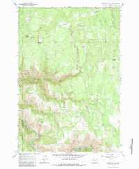
Other maps of this area

1955 · Grangeville
USGS Topo · 1:250,000

1959 · Grangeville
USGS Topo · 1:250,000

1964 · Howard Butte
USGS Topo · 1:24,000

1964 · Akers Butte
USGS Topo · 1:24,000

1964 · Cricket Flat
USGS Topo · 1:24,000

1964 · Wallowa
USGS Topo · 1:24,000

1964 · Minam
USGS Topo · 1:24,000

1964 · Rondowa
USGS Topo · 1:24,000

1967 · Fry Meadow
USGS Topo · 1:24,000

1967 · Promise
USGS Topo · 1:24,000