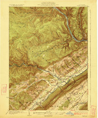
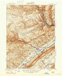
1923 Map of Howard
USGS Topo · Published 1923About this map
Bald Eagle Mountain and the fertile Nittany Valley dominate this early 1920s survey of the Clinton County landscape. The industrial and transport patterns of the era are clearly etched into the terrain, with the Pennsylvania Railroad following the banks of the West Branch Susquehanna River and the Central Railroad of Pennsylvania serving the southern valley. Small settlements such as Orviston and Blanchard are connected by the developing New York State Highway and several state routes.
Find a feature on this map
81 named features on this map. Tap any name to fly to it.
Don’t see what you’re looking for? This feature index may not catch every label — zoom into the map to look around manually.
Map Details
Editions of this 1923 Howard Map
6 editions found
Other maps of this area

1908 · Bellefonte
USGS Topo · 1:62,500

1909 · Bellefonte
USGS Topo · 1:62,500

1921 · Howard
USGS Topo · 1:48,000

1921 · Lock Haven
USGS Topo · 1:62,500

1923 · Howard
USGS Topo · 1:62,500

1923 · Lock Haven
USGS Topo · 1:62,500

1924 · Centre Hall
USGS Topo · 1:62,500

1928 · Snow Shoe
USGS Topo · 1:48,000

1929 · Centre Hall
USGS Topo · 1:62,500

1931 · Show Shoe
USGS Topo · 1:62,500