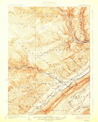
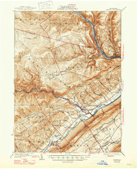
1923 Map of Howard
USGS Topo · Published 1923About this map
Bald Eagle Mountain dominates the southeastern horizon of this central Pennsylvania landscape, creating a massive natural barrier that defines the local transport and settlement patterns. The Pennsylvania Railroad and the West Branch Susquehanna River dictate the movement of goods and people, with the rail line following the contours of the Beech Creek valley. Numerous small one-room schoolhouses such as Sugar Run School, Plunket Run School, and Madden Run School are scattered across the rural townships of Liberty and Beech Creek, illustrating a decentralized early 20th-century educational system. At the foot of the mountain, Beech Creek Sta serves as a critical junction for communities like Blanchard and Eagleville. The upland plateaus to the north, including the Eagleton Fields, show a sparser settlement pattern compared to the fertile Nittany Valley to the south.
Find a feature on this map
84 named features on this map. Tap any name to fly to it.
Don’t see what you’re looking for? This feature index may not catch every label — zoom into the map to look around manually.
Map Details
Editions of this 1923 Howard Map
6 editions found
Other maps of this area

1908 · Bellefonte
USGS Topo · 1:62,500

1909 · Bellefonte
USGS Topo · 1:62,500

1921 · Howard
USGS Topo · 1:48,000

1921 · Lock Haven
USGS Topo · 1:62,500

1923 · Howard
USGS Topo · 1:62,500

1923 · Lock Haven
USGS Topo · 1:62,500

1924 · Centre Hall
USGS Topo · 1:62,500

1928 · Snow Shoe
USGS Topo · 1:48,000

1929 · Centre Hall
USGS Topo · 1:62,500

1931 · Show Shoe
USGS Topo · 1:62,500