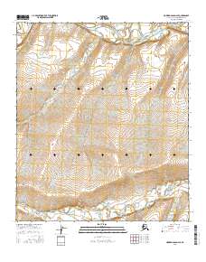
2016 Map of Howard Pass D-2 SE
USGS Topo · Published 2016About this map
Colville River flows across the northern expanse of this North Slope terrain, defining a drainage system that includes Ipnavik River and several smaller tributaries. This 2016 survey by the U.S. Geological Survey documents the braided watercourse patterns and topographic contouring of a remote landscape within the Howard Pass D-2 SE quadrangle. The map tracks the winding path of Blankenship Cr and Culo Cr through the southern sections, illustrating the complex hydrography of the Alaskan Arctic. Geologic and environmental researchers can observe the distinct elevation changes and alluvial features that characterize this sub-arctic environment, providing a technical baseline for studying northern watershed dynamics.
Find a feature on this map
10 named features on this map. Tap any name to fly to it.
Don’t see what you’re looking for? This feature index may not catch every label — zoom into the map to look around manually.
Map Details
Editions of this 2016 Howard Pass D-2 SE Map
This is the sole edition of this map. No revisions or reprints were ever made.
Other maps of this area

1951 · Howard Pass
USGS Topo · 1:250,000

1956 · Howard Pass
USGS Topo · 1:250,000

1984 · Howard Pass D-1
USGS Topo · 1:63,360

1984 · Howard Pass C-1
USGS Topo · 1:63,360
1984 · Howard Pass C-2
USGS Topo · 1:63,360
1984 · Howard Pass D-2
USGS Topo · 1:63,360
2016 · Howard Pass D-2 NE
USGS Topo · 1:25,000
2016 · Howard Pass D-1 SW
USGS Topo · 1:25,000
2016 · Howard Pass D-1 NW
USGS Topo · 1:25,000
2016 · Howard Pass C-1 NW
USGS Topo · 1:25,000