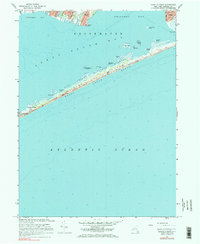
1967 Map of Howells Point
USGS Topo · Published 1984About this map
Fire Island National Seashore dominates the coastal geography of this mid-century survey, shielding the mainland from the Atlantic Ocean. The barrier beach is marked by a network of seasonal access points and coastal landmarks, including Davis Park, Bayberry Dunes, and several named points such as Whalehouse Point and Molasses Point. A Jeep Trail runs the length of the dunes, providing the primary overland route through this protected landscape.
Find a feature on this map
31 named features on this map. Tap any name to fly to it.
Don’t see what you’re looking for? This feature index may not catch every label — zoom into the map to look around manually.
Map Details
Editions of this 1967 Howells Point Map
3 editions found
Other maps of this area

1902 · Setauket
USGS Topo · 1:62,500

1902 · Fire Island
USGS Topo · 1:62,500

1903 · Fire Island
USGS Topo · 1:62,500

1904 · Setauket
USGS Topo · 1:62,500

1904 · Islip
USGS Topo · 1:125,000

1904 · Moriches
USGS Topo · 1:62,500

1919 · Setauket
USGS Topo · 1:62,500

1942 · Islip
USGS Topo · 1:125,000

1947 · Bellport
USGS Topo · 1:24,000

1947 · Howells Point
USGS Topo · 1:24,000