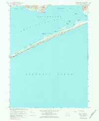
1967 Map of Howells Point
USGS Topo · Published 1984About this map
The coastal transition of the Bellport and Shirley waterfronts characterizes this 1967 survey, where the suburban development of southern Long Island meets the expansive waters of the Great South Bay. Based on field checks conducted by the Geological Survey and hydrographic data from USC&GS charts, the map documents the relationship between these established settlements and the natural barrier beach system. The settlement patterns in Shirley show the grid-style expansion typical of post-war residential growth in Suffolk County, contrasting with the more compact harbor-oriented layout of Bellport. This document serves as a record of the shoreline before significant modern alterations, capturing the specific extent of reach and road networks as they existed in the late 1960s.
Find a feature on this map
2 named features on this map. Tap any name to fly to it.
Don’t see what you’re looking for? This feature index may not catch every label — zoom into the map to look around manually.
Map Details
Editions of this 1967 Howells Point Map
3 editions found
Other maps of this area

1902 · Setauket
USGS Topo · 1:62,500

1902 · Fire Island
USGS Topo · 1:62,500

1903 · Fire Island
USGS Topo · 1:62,500

1904 · Setauket
USGS Topo · 1:62,500

1904 · Islip
USGS Topo · 1:125,000

1904 · Moriches
USGS Topo · 1:62,500

1919 · Setauket
USGS Topo · 1:62,500

1942 · Islip
USGS Topo · 1:125,000

1947 · Bellport
USGS Topo · 1:24,000

1947 · Howells Point
USGS Topo · 1:24,000