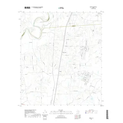
2019 Map of Howth
USGS Topo · Published 2019About this map
The Brazos River carves a winding path along the western edge of this landscape, defining the borders where Washington, Grimes, and Waller counties meet. This area, dominated by the lowlands of Clark Bottom, shows a transition from the river's riparian environment to the structured rural developments around Howth. The corridor is defined by the BNSF Railway, which runs north-south alongside numerous watercourses like Beason Creek and Donahoe Cr.
Find a feature on this map
100 named features on this map. Tap any name to fly to it.
Don’t see what you’re looking for? This feature index may not catch every label — zoom into the map to look around manually.
Map Details
Editions of this 2019 Howth Map
This is the sole edition of this map. No revisions or reprints were ever made.
Other maps of this area

1914 · Navasota
USGS Topo · 1:62,500

1920 · Waller
USGS Topo · 1:31,680

1954 · Beaumont
USGS Topo · 1:250,000

1954 · Austin
USGS Topo · 1:250,000

1956 · Hempstead
USGS Topo · 1:62,500

1957 · Beaumont
USGS Topo · 1:250,000

1958 · Washington
USGS Topo · 1:24,000

1958 · Courtney
USGS Topo · 1:24,000

1960 · Waller
USGS Topo · 1:24,000

1960 · Waller NW
USGS Topo · 1:24,000