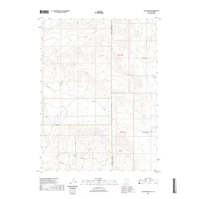
2020 Map of Hoy Mountain
USGS Topo · Published 2020About this map
Hoy Mtn and Wild Mtn dominate this high-desert landscape along the intersection of Uintah and Daggett counties in Utah and Moffat County in Colorado. The drainage patterns of the era are defined by seasonal watercourses like Pot Cr, Dry Cr, and Crouse Cr, which navigate the complex topography between these summits. Strategic water management for the region's ranching or land use is evident in the presence of Tittle Reservoir and Miles Reservoir tucked into the eastern draws. A network of rural tracks, including Pot Creek Rd and Wild Mountain Rd, provides access across the state line, illustrating the remote connectivity between these mountain ranges. The map clearly delineates the convergence of three counties and two states, marking a significant survey point where the rugged Uinta Basin terrain meets the Colorado border.
Find a feature on this map
21 named features on this map. Tap any name to fly to it.
Don’t see what you’re looking for? This feature index may not catch every label — zoom into the map to look around manually.
Map Details
Editions of this 2020 Hoy Mountain Map
This is the sole edition of this map. No revisions or reprints were ever made.
Other maps of this area

1885 · Ashley
USGS Topo · 1:250,000

1952 · Warren Draw
USGS Topo · 1:24,000

1952 · Swallow Canyon
USGS Topo · 1:24,000

1954 · Lodore School
USGS Topo · 1:24,000

1954 · Canyon of Lodore South
USGS Topo · 1:24,000

1954 · Canyon of Lodore North
USGS Topo · 1:24,000

1954 · Vernal
USGS Topo · 1:250,000

1955 · Island Park
USGS Topo · 1:24,000

1955 · Jones Hole
USGS Topo · 1:24,000

1958 · Vernal
USGS Topo · 1:250,000