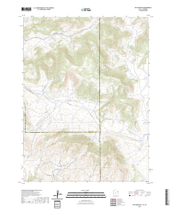
2023 Map of Hoy Mountain
USGS Topo · Published 2023About this map
Jones Hole National Fish Hatchery sits in the southwest corner of this high-altitude landscape, where the Utah and Colorado state lines meet. The terrain is defined by the massive presence of Hoy Mtn and Wild Mtn, which dominate the central and southern portions of the sheet. This area is a network of drainages and seasonal water sources, including the winding Pot Creek, Crouse Creek, and the long descent of Allen Draw. Local water management is evident through features like Tittle Reservoir and Miles Reservoir, which likely serve the ranching or conservation needs of the region. A series of rugged backcountry routes, such as Pot Creek Rd and Wild Mountain Rd, provide the only access through this complex system of ridges and canyons at the intersection of Daggett and Uintah counties.
Find a feature on this map
26 named features on this map. Tap any name to fly to it.
Don’t see what you’re looking for? This feature index may not catch every label — zoom into the map to look around manually.
Map Details
Editions of this 2023 Hoy Mountain Map
This is the sole edition of this map. No revisions or reprints were ever made.
Other maps of this area

1885 · Ashley
USGS Topo · 1:250,000

1952 · Warren Draw
USGS Topo · 1:24,000

1952 · Swallow Canyon
USGS Topo · 1:24,000

1954 · Lodore School
USGS Topo · 1:24,000

1954 · Canyon of Lodore South
USGS Topo · 1:24,000

1954 · Canyon of Lodore North
USGS Topo · 1:24,000

1954 · Vernal
USGS Topo · 1:250,000

1955 · Island Park
USGS Topo · 1:24,000

1955 · Jones Hole
USGS Topo · 1:24,000

1958 · Vernal
USGS Topo · 1:250,000