
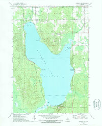
1972 Map of Hubbard Lake
USGS Topo · Published 1972About this map
Hubbard Lake dominates the center of this 1972 survey, straddling the border between Alpena and Alcona counties. The shoreline is dotted with small residential clusters and recreational landings, such as Larson Beach and Backus Beach, reflecting the area's development as a northern Michigan retreat. The surrounding landscape is defined by its water system, with the Lower Thunder Bay River exiting to the north and the West Branch River feeding into South Bay.
Find a feature on this map
37 named features on this map. Tap any name to fly to it.
Don’t see what you’re looking for? This feature index may not catch every label — zoom into the map to look around manually.
Map Details
Editions of this 1972 Hubbard Lake Map
2 editions found
Other maps of this area

1954 · Tawas City
USGS Topo · 1:250,000

1958 · Tawas City
USGS Topo · 1:250,000

1959 · Glennie
USGS Topo · 1:62,500

1959 · Harrisville
USGS Topo · 1:62,500

1971 · Spruce
USGS Topo · 1:24,000
1971 · Ossineke
USGS Topo · 1:24,000

1972 · Hubbard Lake SW
USGS Topo · 1:24,000
1972 · Big Ravine Creek
USGS Topo · 1:24,000
1972 · Evans Creek
USGS Topo · 1:24,000

1983 · Hubbard Lake
USGS Topo · 1:100,000