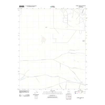
2010 Map of Hubbell Spring
USGS Topo · Published 2010About this map
The Manzanita Mountains define the northeastern corner of this high-desert landscape south of Albuquerque, where water sources like Hubbell Spring and Clear Water Spring were vital historical markers. The map details a transition from the mountain foothills into a vast alluvial plain marked by numerous ephemeral drainage systems, including Arroyo del Coyote and the deep path of Hells Canyon Wash.
Find a feature on this map
16 named features on this map. Tap any name to fly to it.
Don’t see what you’re looking for? This feature index may not catch every label — zoom into the map to look around manually.
Map Details
Editions of this 2010 Hubbell Spring Map
This is the sole edition of this map. No revisions or reprints were ever made.
Other maps of this area

1888 · Bernalillo
USGS Topo · 1:125,000

1889 · Albuquerque
USGS Topo · 1:125,000

1892 · San Pedro
USGS Topo · 1:125,000

1893 · Albuquerque
USGS Topo · 1:125,000

1917 · Estancia
USGS Topo · 1:125,000

1934 · West Albuquerque
USGS Topo · 1:24,000

1934 · East Albuquerque
USGS Topo · 1:24,000

1938 · Albuquerque
USGS Topo · 1:62,500

1952 · Hubbell Spring
USGS Topo · 1:24,000

1952 · Los Lunas SE
USGS Topo · 1:24,000