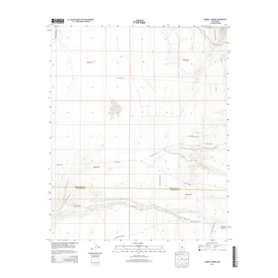
2013 Map of Hubbell Spring
USGS Topo · Published 2013About this map
McCormick Ranch and the expansive southern reaches of Kirtland Air Force Base define this high-desert landscape south of Albuquerque. The terrain is marked by a complex network of traditional routes and modern access ways, including Indian Service Route 602 and various Tribal Roads, which navigate the arid plateaus and deep drainage systems. Water sources are critical markers in this environment, with Hubbell Spring and Clear Water Spring providing vital points of interest alongside the seasonal flow of Hells Canyon Wash. The map also illustrates the administrative boundary between Bernalillo and Valencia counties, cutting through the natural topography of Canada Colorada and the mouth of Cañon de Sanchez.
Find a feature on this map
26 named features on this map. Tap any name to fly to it.
Don’t see what you’re looking for? This feature index may not catch every label — zoom into the map to look around manually.
Map Details
Editions of this 2013 Hubbell Spring Map
This is the sole edition of this map. No revisions or reprints were ever made.
Other maps of this area

1888 · Bernalillo
USGS Topo · 1:125,000

1889 · Albuquerque
USGS Topo · 1:125,000

1892 · San Pedro
USGS Topo · 1:125,000

1893 · Albuquerque
USGS Topo · 1:125,000

1917 · Estancia
USGS Topo · 1:125,000

1934 · West Albuquerque
USGS Topo · 1:24,000

1934 · East Albuquerque
USGS Topo · 1:24,000

1938 · Albuquerque
USGS Topo · 1:62,500

1952 · Hubbell Spring
USGS Topo · 1:24,000

1952 · Los Lunas SE
USGS Topo · 1:24,000