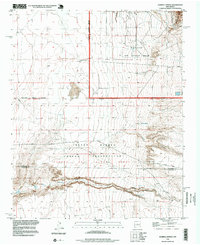
1996 Map of Hubbell Spring
USGS Topo · Published 1999About this map
Isleta Pueblo Indian Reservation lands dominate this mid-century landscape south of Albuquerque, where the high desert terrain transitions into the steep relief of Hells Canyon. The map details a complex intersection of sovereign, military, and municipal boundaries, including the southern edge of Kirtland Air Force Base and the Albuquerque Corporate Boundary. Water remains a central geographic feature in this arid environment, marked by Hubbell Spring and the braided drainage patterns of Hells Canyon Wash and Arroyo del Coyote.
Find a feature on this map
21 named features on this map. Tap any name to fly to it.
Don’t see what you’re looking for? This feature index may not catch every label — zoom into the map to look around manually.
Map Details
Editions of this 1996 Hubbell Spring Map
This is the sole edition of this map. No revisions or reprints were ever made.
Other maps of this area

1888 · Bernalillo
USGS Topo · 1:125,000

1889 · Albuquerque
USGS Topo · 1:125,000

1892 · San Pedro
USGS Topo · 1:125,000

1893 · Albuquerque
USGS Topo · 1:125,000

1917 · Estancia
USGS Topo · 1:125,000

1934 · West Albuquerque
USGS Topo · 1:24,000

1934 · East Albuquerque
USGS Topo · 1:24,000

1938 · Albuquerque
USGS Topo · 1:62,500

1952 · Hubbell Spring
USGS Topo · 1:24,000

1952 · Los Lunas SE
USGS Topo · 1:24,000